
EASY PASS – Before we get started, let’s just make one thing clear: There’s nothing “easy” about the hike to Easy Pass.
Sure, the clearly-marked sign off Highway 20 is easy to spot. The trailhead, unlike many starting points for hikes, is easily accessible, just a short, paved road from the highway.
After that? Easy doesn’t do it.
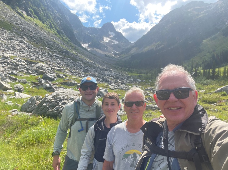
It’s a 3,000-foot climb to the pass. That’s a tough slog for even the hardiest of day hikers. Our group of four – which included my son-in-law Peter, his 11-year-old son Isaac and longtime friend and hiking fanatic Bob “Next Ridge” Swenson – would carry weighty overnight packs up to the summit and down 1,275 feet to our camp at Fisher Creek. With the return trip, that’s a minimum elevation gain of nearly 4,300 feet.
Why Easy Pass? Believe it or not, our original plan was even a more difficult hike to Lake Byrne. That trail along picturesque Lost Creek Ridge in the shadow of Glacier Peak has long been on my bucket list. But Bob, after looking at the topographical map, convinced me to pull the plug on that one.
Even so, this hike would be our group’s most challenging. To paraphrase the title of a popular Eagles song, I had a peaceful, yet uneasy feeling.
Who named this pass? And what were they thinking?


Apparently, someone was trying to be funny. According to historical accounts, the trail was a prospecting route to mines. It was a sarcastic name because there was no “easy route” across the ridge.
No one in our group was laughing when Mother Nature threw us a curve ball on this 27th day nof July on the steepest part of the trail. Just as we were making our way up the final set of exposed switchbacks to the summit, an unexpected thunderstorm rolled through. What started as a drizzle, eventually turned into a driving hailstorm. Even though no rain had been in the forecast, we were caught off-guard. We had not packed rain ponchos.
As we hauled our wet gear to the top and found what little shelter there was under scruffy, wind-whipped trees, Peter, a strong hiker and fearless in many ways, had a look of horror on his face.

“I was not prepared for this,” he said, as he nervously rubbed Isaac’s hands, which had gone numb from the sudden drop in temperature.
Even with dark clouds overhead, however, the views were amazing. Standing at the 6,525-foot summit, you’re reminded why you hike in the first place. Your feet have taken you where few people go.
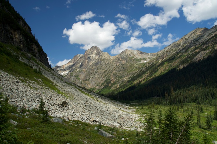
The view to the west, into the heart of North Cascades National Park, is absolutely stunning. With glaciated Mount Logan in the distance, the lush-green valley below runs as far as the eye can see. Looking south, a stream-carved basin leads to snow-topped Fisher Peak. To the east are Golden Horn and Mount Henry, two peaks that straddle the Pacific Crest National Scenic Trail.

Most hikers at this point take their time savoring the views, have lunch, and then make their way back to the trailhead for what amounts to a seven-mile, round trip. The outliers here, we continued down the other side – frozen fingers, soaked backpacks and all – to Fisher Creek Camp, where we had reserved one of three campsites for two nights.

A day of exploring
We woke up to sun on Day 2. Hanging our wet clothes out to dry, we donned light day packs to explore nearby Fisher Creek basin.
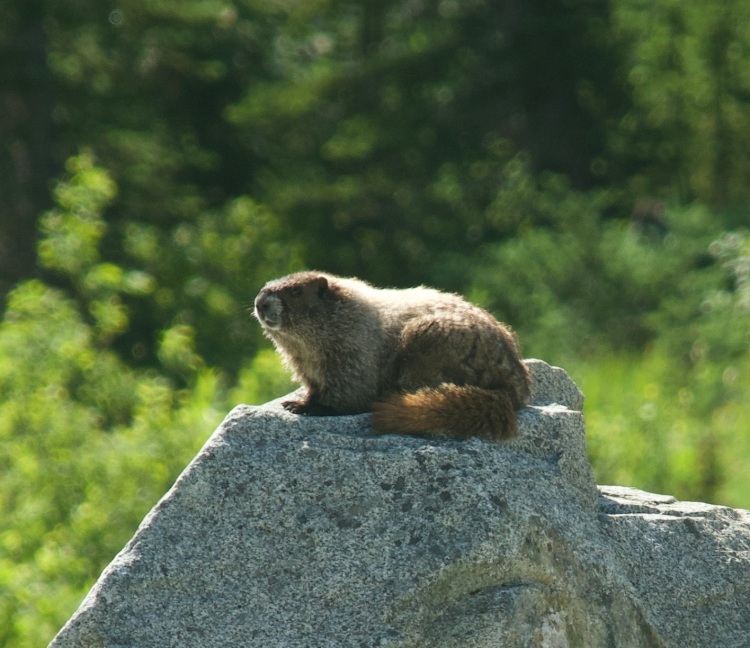
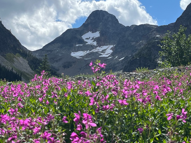
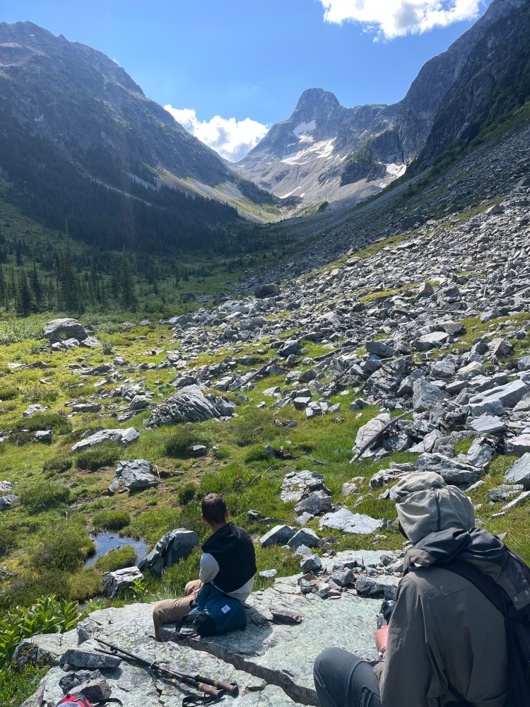
The more lightly-traveled trail from the junction just east of camp hugs the forest for a few hundred yards, before breaking out into a vast Alpine meadow that is nothing short of spectacular. We took pictures of wildflowers, took selfies and lounged on giant-sized boulders and ate our lunch as marmots scurried nearby.
Towering high above the meadow that ends in a mountain version of a cul-de-sac is 8,060-foot Fisher Peak. Looking back to where we came from, the sun glistened off 8,795-foot Mesahchie Peak. We could also see the switchbacks of the trail that would take us up and over Easy Pass the next morning.

We also met backpackers on this side of Easy Pass who, like us, were here for extended stays. A few were headed farther up the Fisher Creek basin to Silent Lakes. Others were even more ambitious. We met backpackers who had dropped cars off on two locations, so as to make the trip one-way. A wilderness ranger checking overnight permits had started at Colonial Creek and was headed to the Easy Pass trailhead, for a total trip of 24 miles. Another group had started at the Panther Creek trailhead. Their final destination at the trailhead off Highway 20 completed a 33-mile journey.
One step at a time
I had struggled two days earlier ascending Easy Pass, having to stop frequently to catch my breath. The return trip over the pass was also challenging. About halfway up, Bob gave made some good advice.
“Try setting step goals,” he said. “For example, tell yourself you’re going to take 25 steps before resting. That way, you’re counting steps and not thinking about how far you have to go.”

I started out at 25 steps, then 35, before working my way to 50. Eventually, I was counting 100 steps before resting. Before I knew it, I was making great progress. Like Bob said, it took my focus off of looking at the summit and realizing how far I had to go.
Isn’t that how life is? The older I get, the more I understand that growth is incremental. The key is discipline. This can be true of an exercise regiment or a diet plan. You cannot meet your weight goal or get fit overnight. As a Christian, I have found that daily time spent in God’s Word and prayer has a stacking-bricks effect. It’s the accumulation of days that ultimately stimulates lasting growth and liberates potential. There are no short cuts.

There were certainly no quick fixes or short cuts back to the trailhead. It took us about seven hours from the Fisher Creek Camp to make our way back. In the parking lot, I had a conversation with a couple younger day hikers from Oregon we had met earlier in the day at the Easy Pass summit.
As I removed my overnight pack, one of the women exclaimed, “That was a tough day hike, one of the tougher ones I’ve done. I can’t imagine hauling a backpack up there.”
Easy? No. Worth it? Definitely.


Leave a comment